| 1777
Engraving Historic Maps of Northern New Jersey |
|
| Maps Home • 1777 Engraving • 1780 Map • 1839 Map • Railroad Map |
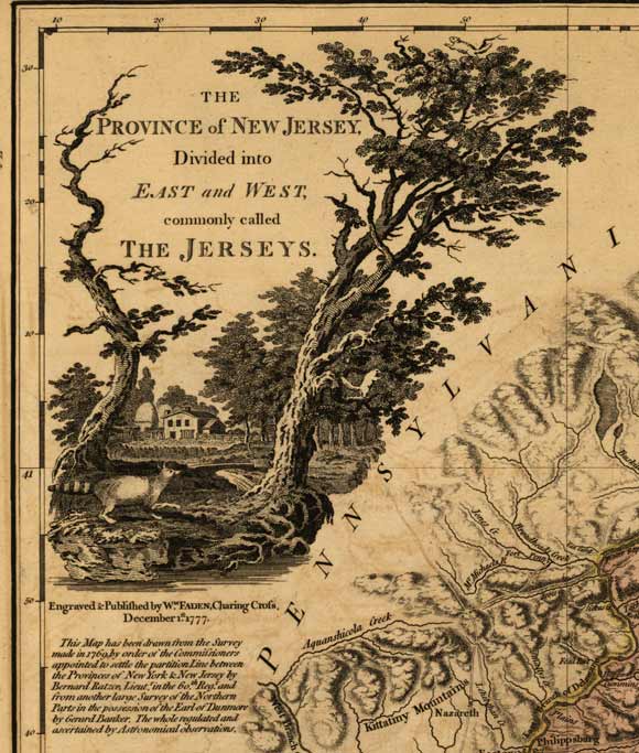
This engraving is from a map published in 1777 of "The Province of New Jersey, divided into East and West New Jersey. The map has been drawn from the survey made in 1769...by Bernard Ratzer...and from another large survey of the Northern Parts...by Gerard Banker". You can see in this detail of the map squirrels, a raccoon with a farm house and silos in the background.
Home • Scenery • History • Recreation • Home & Garden • Directory • Calendar • Classified Ads
• Maps • Scenery • Shopping
Advertise on rt23.com!
• Link to rt23.com!

Custom Search
Questions, comments, corrections? contact the Webmaster